

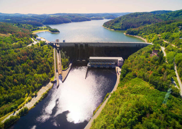
Lake Powell is now so low that one more bad year could flip the switch on a major source of Western power.
Story Snapshot
- Lake Powell sits only about 35 feet above the point where Glen Canyon Dam loses all hydropower.
- The reservoir is about 23 percent full and has dropped roughly 35–40 feet in a single year.
- Federal managers have already ordered emergency cutbacks and warn of record-low levels in the near term.
- Advocacy groups and media push a crisis narrative, while federal agencies speak in careful technical language.
Lake Powell is running out of room to fall
Lake Powell was built as a giant battery for the American West, turning the Colorado River into steady water and steady power. Today that battery is almost drained.
Live elevation trackers show the lake hovering near 3,524 to 3,526 feet above sea level, more than 170 feet below its designed full pool and only about 35 feet above the minimum level needed to run Glen Canyon Dam’s turbines.
The reservoir holds barely a quarter of the water it was built to store, and the downward slide has not stopped.
The term that matters here is “minimum power pool.” Below roughly 3,490 feet, Glen Canyon Dam can no longer safely and reliably push water through its hydropower turbines. At that point, the dam becomes a concrete wall with limited outlets, not a power plant feeding the grid.
Some news headlines throw around “dead pool,” which is even lower, where water would stop flowing out at all. That confusion masks a hard truth: from the standpoint of electricity, Lake Powell is already very close to the line that counts.
Lake Powell, the second-largest reservoir in the U.S. located in Arizona and Utah, is nearing critically low water elevation levels, the latest data shows.
Read more: https://t.co/tYDgXZ8PgR pic.twitter.com/qkqLYovE1l
— ABC News (@ABC) July 14, 2026
How the lake fell toward the power cutoff line
The fall of Lake Powell is not a one-year shock. It is the visible result of more than two decades of tight water math across the Colorado River Basin.
Since 2000, the combined storage in Lake Mead and Lake Powell has dropped by about 33.5 million acre-feet, a decline of more than 40 percent.
Researchers tie this to both heavy water use and a long “megadrought” that has cut natural river flows well below the amounts promised on paper.
Federal models make the picture sharper. The Colorado Basin River Forecast Center projects only about 3.27 million acre-feet of unregulated inflow to Lake Powell this water year, about one-third of the historical average.
At the same time, past operating plans assumed much higher downstream releases. When you move more water out than comes in—year after year—the reservoir must fall. That is simple balance-sheet thinking, and the numbers now show the result in real-depth loss.
Emergency federal moves and what they really signal
Faced with that math, the Bureau of Reclamation has stopped pretending this is business as usual. In earlier years, its 24‑month studies called for releases on the order of 7.48 million acre-feet from Lake Powell.
New guidance cuts planned releases to about 6 million acre-feet and pairs that with extra water from upstream storage, including Flaming Gorge Reservoir. Officials say these moves are meant to keep Lake Powell well above minimum power pool for at least the next couple of years.
On paper, those interventions buy time. Bureau outlooks have suggested that with reduced releases, the lake could rise dozens of feet in wet seasons and stay 80 to 100 feet above the turbine cutoff in the short term. But those optimistic scenarios depend on a better snowpack and inflows than the basin has seen recently.
When inflow falls to one-third of normal, as this year’s forecast warns, the cushion shrinks quickly. That is why outside experts warn of new record lows as early as late summer.
Who is framing this crisis, and why it matters
Most of the urgent language—“nearing dead power pool,” “running out of time”—comes from advocates and local experts, not from the Bureau of Reclamation itself. Groups like the Glen Canyon Institute have long argued that Lake Powell should be drained and river canyons restored, so they highlight every new low as proof the reservoir is doomed.
Their warnings often line up with the hard data, but their policy agenda leans toward worst‑case interpretations, which deserve a careful eye from anyone who values balanced information.
Lake Powell reaching critically low elevation levels, nearing 'dead power pool,' experts say
As of Monday, water levels at Lake Powell measured at 3,524.3 feet above sea level, according to the @USBR tracker. https://t.co/SzEBusvdse
Minimum, or "dead," power pool — in which… pic.twitter.com/p9T8qb8mJw
— Water Mark 🚰 (@OtayMark) July 14, 2026
Federal agencies use cooler phrasing. They publish elevations, inflow forecasts, and release plans, but they avoid bold public claims about exact dates when power will shut off. That cautious style fits with conservative values about responsible stewardship and avoiding panic.
However, it also leaves a gap that media and YouTube channels are happy to fill with dramatic countdowns and maps of catastrophe. Many of those videos rely on the same government numbers but strip away nuance, which can mislead viewers about what is certain and what is still a range of outcomes.
The stakes for power, water, and common-sense planning
Hydropower from Glen Canyon Dam is not just about lights for houseboats. It supports the Western electric grid and helps keep rates lower for families and businesses across several states. If Lake Powell crosses the minimum power pool line, that energy disappears and must be replaced with other sources, often at higher cost.
The water story is even larger. Below Lake Powell lies Lake Mead, which supplies water to cities and farms for about 40 million people in the Southwest.
Models show that under current rules, both reservoirs face “substantial risks” of hitting critical levels, including inactive and dead pools, in coming decades.
That is not a partisan talking point; it is the product of math that does not care about election cycles. Serious planning now—tightening use, revisiting old water promises, and investing in efficient technology—aligns with both environmental prudence and the traditional desire to face reality instead of wishful thinking.
Sources:
abcnews.com, usbr.gov, youtube.com, eros.usgs.gov, facebook.com, lakepowell.water-data.com, powell.uslakes.info, colorado.edu, congress.gov